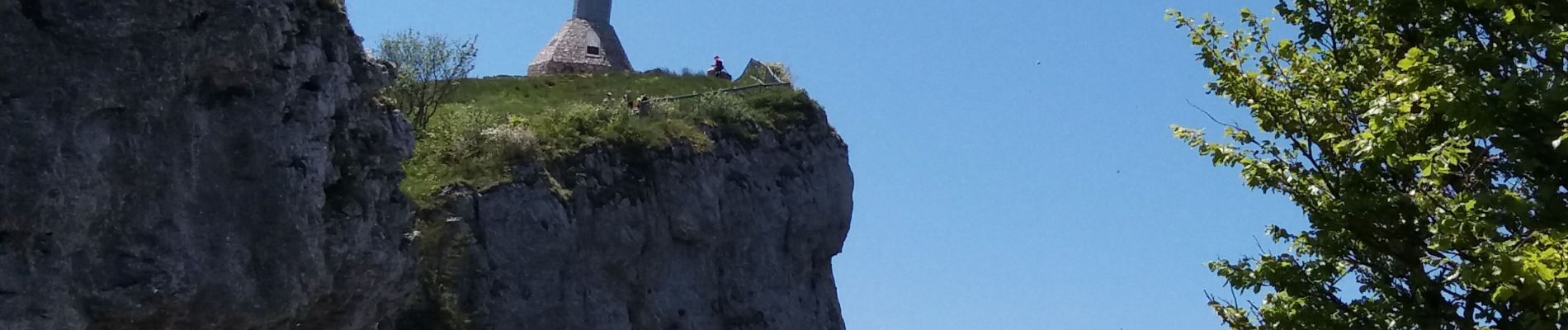
BAUGES: LA FECLAZ - CROIX DU NIVOLLET

djeepee74
User
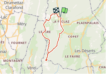

Length
12.2 km

Max alt
1544 m

Uphill gradient
427 m
Km-Effort
17.9 km

Min alt
1291 m

Downhill gradient
429 m
Boucle
Yes
Creation date :
2020-05-19 08:18:08.894
Updated on :
2020-05-26 15:57:16.085
4h00
Difficulty : Medium

FREE GPS app for hiking
 SityTrail
IGN / Geographical institutes
SityTrail Plus
The world is yours!
About
Trail Walking of 12.2 km to be discovered at Auvergne-Rhône-Alpes, Savoy, Les Déserts. This trail is proposed by djeepee74.
Description
BOUCLE... 20200519 en live
Photos


Positioning
Country:
France
Region :
Auvergne-Rhône-Alpes
Department/Province :
Savoy
Municipality :
Les Déserts
Location:
Unknown
Start:(Dec)
Start:(UTM)
732404 ; 5059310 (31T) N.
Comments